

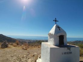
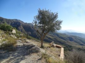
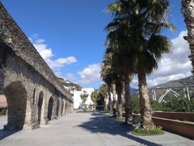
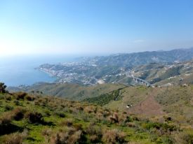
This circular route starts in the village of Nerja. The route is 8.89 km long, has an elevation of 366 m and takes approximately 3.5 hours to complete.
Elevation Gain: 366
540 views
More info
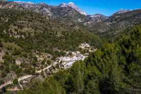
This beautiful circular route starts in the village of Guájar Alto. The route is 6.91 km long, has an elevation of 251 m and takes approximately 2.5 hours to complete.
Elevation Gain: 261
549 views
More info

This circular route starts at the Hotel Suites Salobreña and walks to Salobreña, visiting some of the most interesting sights along the way. The route is 10.51 km long, has an elevation of 260 m and takes approximately 3 hours to complete.
Elevation Gain: 260
629 views
More info
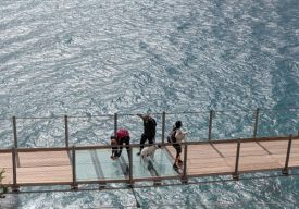
This route explores the cliffs and viewpoints around Torrenueva with its hanging walkway. The route is 10.8 km long, has an elevation of 138 m and takes about 3.5 hours to complete.
Elevation Gain: 138
1328 views
More info

This scenic circular route goes from the village Árchez to Canadillas de Albaida. The route is 6.02 km long, has an elevation of 238 m and takes about 3 hours to complete.
Elevation Gain: 238
1333 views
More info

This circular route goes from Torrox Costa to Torrox Pueblo. The route is 12.67 km long, has an elevation of 243 m and takes about 4 hours to complete.
Elevation Gain: 243
1287 views
More info

This circular route explores the hills around the Mirador de la Cabra on the old Carretera de la Cabra. The route is 10.37 km long, has an elevation of 343 m and takes about 4 hours to complete.
Elevation Gain: 343
1592 views
More info

On this circular route, we follow the Río Ízbor from the village of Ízbor to the Embalse de Beznar. The route is 10.24 km long, has an elevation of 435 m and takes about 4 hours to complete.
Elevation Gain: 435
1355 views
More info

On this linear route, we walk from the village of Vélez de Benadaulla to the Embalse de Rules. The route is 11.07 km long, has an elevation of 223 m and takes about 4 hours to complete.
Elevation Gain: 223
904 views
More info

This corrected circular route explores the hills above the village of Vélez de Benadaulla. The route is 11.08 km long, has an elevation of 431 m and take about 4 hours to complete.
Elevation Gain: 431
1156 views
More info
This circular route goes from the Loma del Gato to La Palma and then to the Cerro de Ítrabo. The route is 9.43 km long, has an elevation of 460 m and takes about 4 hours to complete.
Elevation Gain: 460
1631 views
More info
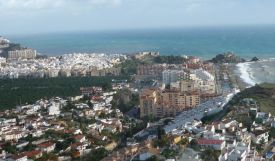
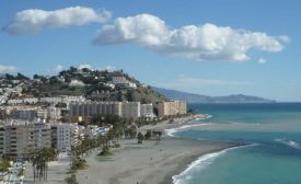
This route explores the beaches and points of interest in Salobreña. The route is 10.14 km long, has an elevation of 113 m and takes about 3.5 hours to complete.
Elevation Gain: 113
2186 views
More info
The route starts near the village of Lentegí and walks up to El Puntal. The route is 12.2 km long, has an elevation of 539 m and takes about 5 hours to complete.
Elevation Gain: 539
2282 views
More info
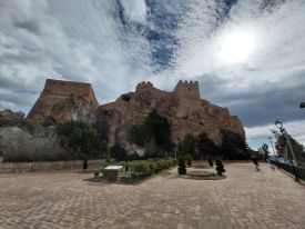
This circular route starts by the Cueva de Nerja. The route is 11.29 km long, has an elevation of 360 m and takes about 5 hours to complete.
Elevation Gain: 359
2647 views
More info
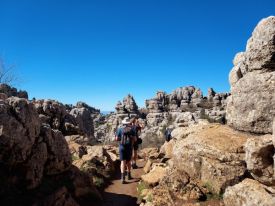
This route explores the Paraje Natural del Torcal de Antequera. The route is 4 km long, has an elevation of 64 m and takes about 3 hours to complete.
Elevation Gain: 64
1967 views
More info
This circular route explores the Sierra del Chaparral near Molvízar. The route is 8.4km long, has an elevation of 401m and takes about 3.5 hours to complete.
Elevation Gain: 401
1981 views
More info
This linear routes walks up to the top of the Cerro de la Salchicha at 1545m. The route is 8.7km long, has an elevation of 306m and takes about 4 hours to complete.
Elevation Gain: 306
1550 views
More info
This circular route starts at the Área Recreativa El Mirador near Motril and goes up to the Cerro del Toro. The route is 11.3km long, has an elevation of 352m and takes about 4 hours to complete.
Elevation Gain: 352
2966 views
More info
This hiking and cycle route explores the town of Almuñécar. It is 11.3km long, has an elevation of 206m and takes about 3 hours to complete.
Elevation Gain: 206
2140 views
More info
This mainly linear walk starts in Maro and explores the area of the Parque Natural de Tejeda, Almijara y Alhama. The route is 11km long, has an elevation of 334m and takes about 4 hours to complete.
Elevation Gain: 334
2052 views
More info
This circular route explores the hills above the villages of the Guájares. The route is 8.05 km long, has an elevation of 345 m and takes about 4 hours to complete.
Elevation Gain: 345
3563 views
More info
This circular route starts in Salobreña and goes to Lobres. The route is 14.4km long, has an elevation of 111m and takes about 4 hours to complete.
Elevation Gain: 111
3567 views
More info
This circular route explores the area about the Río Guadalfeo near the village of Vélez de Benaudalla. The route is 14km long, has an elevation of 450m and takes about 5 hours to complete.
Elevation Gain: 423
4087 views
More info
This walk explores some of the coves and beaches of Almuñécar. The walk is 10.8km long and takes about 4 hours to complete.
Elevation Gain: 123
2060 views
More info
A walk around the back of Molvízar. 11.6km with 480m elevation
Elevation Gain: 480
3774 views
More info
This route explores the area between Jete and Itrabo. The route is 11.42 km long, has an elevation of 419 m and takes about 4 hours to complete.
Elevation Gain: 419
2976 views
More info
On this route, we walk up to the top of Pico Almendrón. The walk is approximately 13km long and takes about 6 hours to complete.
Elevation Gain: 948
1574 views
More info
This route visits some of the historical Roman monuments and sights in Almuñécar. The walk is 13 km long and takes approximately 4 hours to complete.
Elevation Gain: 152
3848 views
More info
This is a lovely route up the hills to the west of Almuñecar. You get some great views as you climb and you see a lot of new hidden valleys. Elevation Gain: 279 Distance: 7.7 Km.
Elevation Gain: 261
2905 views
More info
This route explores the Sierra de Cázulas and the hills above Lentegí. The walk is about 13km long and take approximately 6 hours to complete.
Elevation Gain: 708
1810 views
More info
This route starts in the picturesque village of Frigiliana. We walk through the town to a track that leads up to El Fuerte which is a mountain with incredible views. The walk is 8km long and takes about 4 hours to complete.
Elevation Gain: 658
2916 views
More info

This route goes from Cotobro to La Herradura. The walk is 14.6 km long, has an elevation of 451 m and takes about 5 hours to complete.
Elevation Gain: 451
2905 views
More info
This route explores the hills above Ítrabo and Jete. The walk is 8.5km long and takes about 4 hours to complete.
Elevation Gain: 372
1572 views
More info
This route explores the hills above Maro. The walk is 10km long and takes about 3 hours to complete.
Elevation Gain: 475
3221 views
More info
This route explores the hills and the acequias above Lanjarón. The walk is 10.2km long and takes about 4 hours to complete.
Elevation Gain: 535
1932 views
More info
This route explores the hills above Lanjarón and the acequias of the Río Lanjarón. The walk is 12km long and takes about 4 hours to complete.
Elevation Gain: 560
3986 views
More info
This route explores the Cerro Moscaril near La Gelibra. The walk is 14.3km long, has an elevation of 633m and takes about 5 hours to complete.
Elevation Gain: 633
1773 views
More info
This route explores the Sierra de Ítrabo and goes up and around La Guindalera. The walk is 13.6km long and takes approximately 4.5 hours to complete.
Elevation Gain: 563
1374 views
More info
This is an easy circular hike from the village of Guajar Alto. The walk is 8km long and takes approximately 3 hours to complete.
Elevation Gain: 315
2006 views
More info
This beautiful walk explores the Sierra de Ítrabo, the hills north of Ítrabo. This walk is 8.9km long and takes approximately 3.5 hours to complete.
Elevation Gain: 443
1710 views
More info
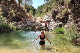
This is a moderate walk from the Área Recreative El Bacal near Jayena along the Río Bacal to the Poza del Romance. This walk is 8.9km long and takes approximately 3.5 hours to complete. There is a pool which you can jump into.
Elevation Gain: 113
1824 views
More info
This circular walk explores the hills above Lentegí. This walk is 9.3km long and takes approximately 3 hours to complete.
Elevation Gain: 427
1949 views
More info
This is a longer version of the Fishermen's Walk. We walk from Cotobro to La Herradura and there are lovely views of the beaches and the bays below. This walk is 14.49 km long, has an elevation of 476 m and takes approximately 4 hours to complete.
Elevation Gain: 476
1854 views
More info
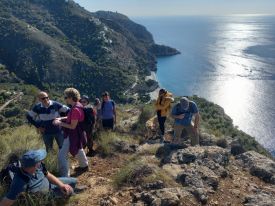
On this circular coastal walk, we walk from Cerro Gordo to Playa Cantarriján and Playa Cañuelo and then back. This route is 10.65 km long, has an elevation of 496 m and takes about 4.5 hours to complete.
Elevation Gain: 496
5672 views
More info
This route starts with a steep initial climb up and continues along the El Pinar ridge towards Puerto Blanquilla and then down to the village. This walk is 11.5km long, has an elevation of 428m and takes about 4 hours to complete.
Elevation Gain: 428
3469 views
More info
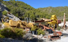
This Maro circular route walks up to a stone arch, an abandoned quarry and an old cortijo ruin. The walk is 9.71km long and takes approximately 3 hours to complete.
Elevation Gain: 453
1690 views
More info
This is a fairly strenuous walk up and around the hills above the village of Molvízar. The walk is 15.3km long and takes approximately 5.5 hours to complete.
Elevation Gain: 618
1486 views
More info
This is an easy walk into the hills behind Almuñécar and there are good views over the sea above Taramay. This walk is 13km long and takes approximately 5 hours to complete.
Elevation Gain: 334
4323 views
More info
This is an easy, short circular walk from Playa Cantarriján to Playa Cañuelo. This walk is 6km long and take approximately 3 hours to complete.
Elevation Gain: 240
2227 views
More info
This is a short version of the Fishermen's Walk. We climb up to the hills above Marina del Este and La Herradura and there are lovely views of the beach and the bay. This walk is 6.5km long and takes approximately 3 hours to complete.
Elevation Gain: 228
4830 views
More info
This circular route walks up from Mesón Los Prados to Pico Lopera. The walk is 12.5 km long, has an elevation of 397 m and takes about 4 hours to complete.
Elevation Gain: 397
4730 views
More info
This lovely scenic trail has spectacular mountain scenery and passes a lake and a petrified tree waterfall. This walk is 9.6km long, has an elevation of 389m and take about 4 hours to complete.
Elevation Gain: 389
4984 views
More info
This walk explores the hills above the village of Lentegí. The route is 15.8km long, has an elevation of 523m and takes approximately 5 hours to complete.
Elevation Gain: 523
2950 views
More info
This linear walk was named the "Bee-eater Walk" by Trevor because in the spring and summer, it is possible to see brightly-coloured Bee Eater birds. This walk is approximately 10.61 km long, has an elevation of 498 m and takes about 4 hours to complete.
Elevation Gain: 498
3886 views
More info
This clockwise route is the longest of the walks above the village Acebuchal. It climbs up to below the Venta de Panaderos and has fantastic views. This walk is approximately 19km long and takes approximately 6 hours to complete.
Elevation Gain: 516
1693 views
More info