
This mainly linear walk starts in Maro and explores the area of the Parque Natural de Tejeda, Almijara y Alhama. The route is 11km long, has an elevation of 334m and takes about 4 hours to complete.
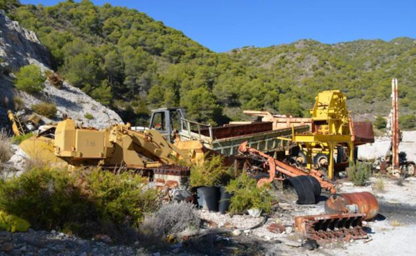
The walk starts in the Maro carpark. From here, we walk up to the abandoned quarry with the remains of all the old work vehicles. We then head into the first barranco and follow this passing a stone arch and up to the cortijo at the top of the hill. Here, there are fantastic views of the coast and the surroundings. We then retrace our steps with a diversion off to the right into the second barranco which we follow down to return to the starting point.
| Distance | 10.95 km |
| Duration | 3 hours 40 minutes GPX ------ 3 hours 34 mins (Naismith) |
| Total Climb | 334 m |
| Highest Point | 428 m |
| Weather Link | Click here |
Meeting Point: Maro: public carpark
See map full screen Click here
Note: You can choose different types of maps using the drop down (top right) EG ArcGis Ariel is satelliteSorry we do not allow download of the gpx file of this walk because our group suffered a takeover by the weasly walkers. Click here if you would like to know what a walking group takeover is.
This page has been seen 2053 times since - 27th January 2023