
This route visits some of the historical Roman monuments and sights in Almuñécar. The walk is 13 km long and takes approximately 4 hours to complete.
We visit some points of interest in Almuñecar:
We start off by climbing up to the Peñón del Santo which is a promontory in the centre of Almuñecar with a large cross and great views of the coast and mountains.
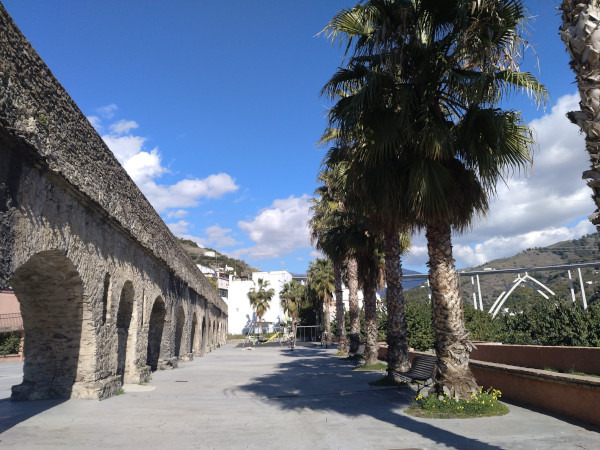
After that we pass through Majuelo park which has the archaeological remains of a fish salting factory dating back to the 4th century BC. This facility was renowned for producing "garum," a fermented fish sauce highly prized across the Roman Empire. Afterwards we visit many parts of the Roman aqueduct, built during the 1st century AD, designed to bring fresh water from the nearby mountains to the settlement of Sexi Firmum Iulium (modern-day Almuñécar). The structure includes multiple arches, some of which are still intact. Finally visit the Columbarium which is a mausoleum used as a burial site for members of a prominent Roman family. Some of the walk follows the Rio Seco and Rio Verde, the two main rivers in Almuñecar. At the end of the walk we usually have a drink in one of the many excellent tapas bars.
| Distance | 13.001 km |
| Duration | 4 hours 36 minutes GPX ------ 3 hours 38 mins (Naismith) |
| Total Climb | 152 m |
| Highest Point | 93 m |
| Weather Link | Click here |
Meeting Point: Almuñécar: sports stadium
LINK 1: Info about Garum
LINK 2: Photos
See map full screen Click here
Note: You can choose different types of maps using the drop down (top right) EG ArcGis Ariel is satelliteSorry we do not allow download of the gpx file of this walk because our group suffered a takeover by the weasly walkers. Click here if you would like to know what a walking group takeover is.
This page has been seen 3804 times since - 28th February 2022