
This walk explores the hills above the village of Lentegí. The route is 15.8km long, has an elevation of 523m and takes approximately 5 hours to complete.
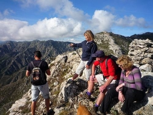
The hidden Buddha walk is a linear walk up to the top of a mountain, with an uphill of 523 metres. The walk is easier than it sounds by distance because it is a very steady climb. The final part involves some fairly easy scrambling. We eat at the summit, which is at 1201 metres, where the views are excellent. Almost all of the walk is along wide 4x4 tracks so it is easy to speak to more than 1 person while walking. The best place to go for a beer afterwards is the Capricho in Otivar which does very good tapas and has a large outside space. There are also 2 bars in Lentegí. Note: We decided it would be a better idea after the walk in Jan 2022 to have the meeting point as the road up to lenteji becuase some people got lost. We removed the meeting point for the start of the actual walk here is a link
| Distance | 15.714 km |
| Duration | 5 hours 47 minutes GPX ------ 5 hours 14 mins (Naismith) |
| Total Climb | 523 m |
| Highest Point | 1201 m |
| Weather Link | Click here |
Meeting Point: Start of the Road to Lentegí
LINK 1: See more info on all trails.
See map full screen Click here
Note: You can choose different types of maps using the drop down (top right) EG ArcGis Ariel is satelliteSorry we do not allow download of the gpx file of this walk because our group suffered a takeover by the weasly walkers. Click here if you would like to know what a walking group takeover is.
This page has been seen 2914 times since - 16th January 2022