
This circular route starts in the village of Nerja. The route is 8.89 km long, has an elevation of 366 m and takes approximately 3.5 hours to complete.
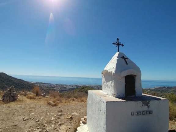
The route starts above the village of Nerja. We follow the Corredor de la Molineta up to the Fábrica de Luz. The next section is steeper as we follow the track through the forest to the Cruz de Pinto at 380 m above sea level. The track down is more gentle and we then join up with a wider track with a more gentle descent back to the starting point.
Note the forest section is quite steep and when we did it some pine trees had blocked the path but they were easy to go around. You don't have to cross any rivers on this route.
| Distance | 8.887 km |
| Duration | 2 hours 50 minutes GPX ------ 3 hours 8 mins (Naismith) |
| Total Climb | 366 m |
| Highest Point | 392 m |
| Weather Link | Click here |
Meeting Point: Nerja: Parking in Calle Mirto
See map full screen Click here
Note: You can choose different types of maps using the drop down (top right) EG ArcGis Ariel is satelliteSorry we do not allow download of the gpx file of this walk because our group suffered a takeover by the weasly walkers. Click here if you would like to know what a walking group takeover is.
This page has been seen 544 times since - 2nd March 2026