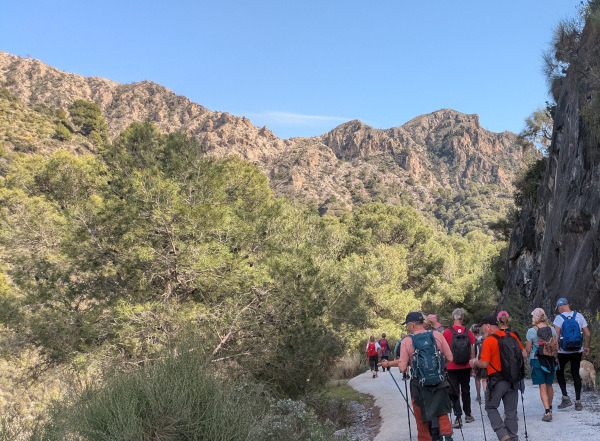

This beautiful circular route starts in the village of Guájar Alto. The route is 6.91 km long, has an elevation of 251 m and takes approximately 2.5 hours to complete.
The route starts in the village of Guájar Alto. Along the way, we will see some beautiful scenery and enjoy some amazing views. We walk up out of the village through the Barranco del Valle to the highest point of the walk at 692 m. We then make our way down through the Barranco del Fuerte to follow the Río de la Toba. After the ruined cortijo, we follow the track back to the starting point, passing the Cascada de la Toba.
The walk is easy but there are a couple of places with uneven gravel so don't take your great grandmother. There are normally a couple of bars in the village to have a beer.
| Distance | 6.912 km |
| Duration | 2 hours 16 minutes GPX ------ 2 hours 23 mins (Naismith) |
| Total Climb | 261 m |
| Highest Point | 701 m |
| Weather Link | Click here |
Meeting Point: Layby on the road up to Los Guájares
See map full screen Click here
Note: You can choose different types of maps using the drop down (top right) EG ArcGis Ariel is satelliteSorry we do not allow download of the gpx file of this walk because our group suffered a takeover by the weasly walkers. Click here if you would like to know what a walking group takeover is.
This page has been seen 550 times since - 23rd February 2026