
A trip around the old part of Granada which includes the Albaicín and Sacromonte. It is 7km. After living in this area for 10 years this is the route I would go on if I were a tour guide.
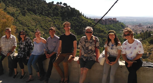
I lived in the Sacromonte and Albayzín for over 10 years and I have taken dozens of visitors for walks around this area. This walk will definitely give you a good idea of many of the interesting places. For many years I saw tourists walking around with maps totally lost in the area. The truth is that normal paper maps are almost impossible to follow. If you download the gpx file and follow the route you are guaranteed a fairly good walking tour. The photo above was taken at the Sacromonte Abbey which is about halfway around the track.
View from Carvajales Verea de Enmedio Caldereria
| Distance | 7.004 km |
| Duration | 2 hours 12 minutes GPX ------ 2 hours 27 mins (Naismith) |
| Total Climb | 278 m |
| Highest Point | 803 m |
| Weather Link | Click here |
Meeting Point: Plaza Nueva Granada
See map full screen Click here
Note: You can choose different types of maps using the drop down (top right) EG ArcGis Ariel is satelliteDownload GPX file We give you permission to download the gpx file of this route and follow it on your smartphone. Please note that we own the copyright to this file and you cannot upload it somewhere else in the same way that you can't copy a Beatles song and then claim that you made it. Click here if you would like to know more about copyright of internet content.
This page has been seen 10129 times since - 7th March 2022