
This route follows the Collado del Diablo. The walk is 13.9km long and takes about 5 hours to complete.
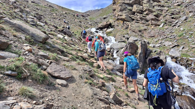
Great walk for when it gets hot at lower altitudes and there is lots of snow melt from the snowy peaks. (Mid - May, June, July) The walk starts just above the Sierra Nevada Pradollano Ski Resort. We follow the Collado del Diablo and make our way down to the Refugio San Francisco, walking through the Arroyo de San Juan to the Piedra Resbaladiza. After following part of the Acequia de Hoyo Puente, we walk up to the top of Morrón de Haza Mesa at 2208m. We then continue on the othe side of the Haza Mesa and follow the Acequia Haza Mesa back to the start of the loop. We then retrace our steps back to the starting point. Note that when going for a beer most places get fuller as you go down the hill so go to the first place that has space.
Refugio San Francisco CASCADA DE PIEDRA RESBALADIZA
| Distance | 13.916 km |
| Duration | 4 hours 41 minutes GPX ------ 4 hours 20 mins (Naismith) |
| Total Climb | 344 m |
| Highest Point | 2320 m |
| Weather Link | Click here |
Meeting Point: Sierra Nevada: Collado del Diablo - Cascada Piedra Resbaladiza
See map full screen Click here
Note: You can choose different types of maps using the drop down (top right) EG ArcGis Ariel is satelliteSorry we do not allow download of the gpx file of this walk because our group suffered a takeover by the weasly walkers. Click here if you would like to know what a walking group takeover is.
This page has been seen 2851 times since - 14th May 2022