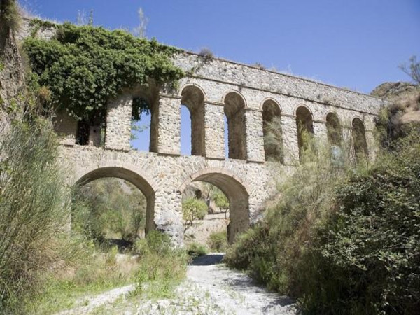

This clockwise circular route goes from the village of Dúdar to the Dehesa del Generalife and passes the Canal and the Acueducto de los Franceses. It is 13.4km long, has an elevation of 377m and takes approximately 5 hours to complete.
This lollipop route begins in the village of Dúdar, near Quéntar. We begin by walking up to the Acueducto de los Franceses and then follow the Camino de Belén, past the remains of the Canal de los Franceses and up to the Peña de los Agujeros, the higest point of the walk. We then walk on to the Cortijo La Marra and then reach the Dehesa del Generalife. We follow the track round to the Cortijo de Belén, which was built in 1882, and then on up to the Ermita del Santo Cristo del Almecí. From here, we make our way back to the starting point.
| Distance | 13.414 km |
| Duration | 4 hours 28 minutes GPX ------ 4 hours 18 mins (Naismith) |
| Total Climb | 377 m |
| Highest Point | 1053 m |
| Weather Link | Click here |
Meeting Point: Dúdar: carpark
See map full screen Click here
Note: You can choose different types of maps using the drop down (top right) EG ArcGis Ariel is satelliteSorry we do not allow download of the gpx file of this walk because our group suffered a takeover by the weasly walkers. Click here if you would like to know what a walking group takeover is.
This page has been seen 2712 times since - 21st December 2022