

Walk History Page
Here is a list of people who attended a great day of hiking.
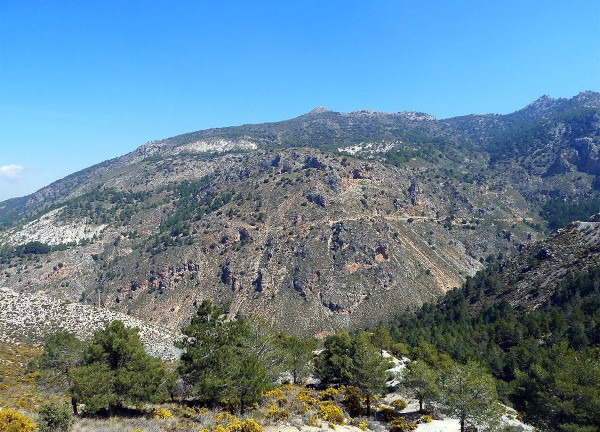
Monachil: Cerro de Huenes
Sunday 21st of April 2024 11:00 AMThis route explores the area south of Monachil. The route is 10.87 km long, has an elevation of 344 m and takes approximately 4.5 hours to complete.
LONG DESCRIPTION
The route starts just outside the village of Monachil. From the carpark, we follow the Pista del Cortijo del Hervidero with a fairly gentle uphill section up to the Cerro Redondo. We then walk through the Barranco de Corvales to the Collado del Tejarillo and on through the Barranco de la Cuesta de Formes. We then walk through the Cortijo del Balzaín before crossing the Carretera a Cumbres Verdes. There is now an off-piste section through the Llanos de Satajardas to connect up later with another track which we follow to El PUntal and then back to the starting point.
More info Link:
https://walkingroup.com/routes/senderismo-granada/monachil-cerro-huenes
Meeting Point:
https://walkingroup.com/mp/monachil-area-recreativa-los-llanos
Notes about names:
Please use your full name for identification.
You can put several people on the same line by putting "AND" or "&" between the names: Julio Iglesias and Penelope Cruz.
Use "+" to include your dog.
Max People: 35
There are 21 people signed up at the moment.
There are 14 spaces left.
There are 0 VIP walkers .
| pax | Name | ||
|---|---|---|---|
| 2 | Sarah Brenchley y John Butts + Shep | 17 | |
| 1 | Lilli Bender | 17 | |
| 1 | Orla Moroney | 17 | |
| 1 | Silvia Guerrero | 17 | |
| 1 | Carlos Sant | 17 | |
| 1 | Emmanuelle Clergue | 17 | |
| 1 | Laureano Cano | 17 | |
| 1 | MJosé Rodríguez | 17 | |
| 1 | Gonzalo Peña | 17 | |
| 3 | Sarah Dowsett and José Martínez and Danny Martínez + Toby | 17 | |
| 1 | José Gamez Molina | 17 | |
| 1 | Javier García Villanova | 17 | |
| 1 | Melanie Valois | 17 | |
| 1 | Juan bautista jurado | 17 | |
| 1 | Joaquín Delgado Pastor | 17 | |
| 2 | Carmen Sánchez y Antonio Herrera | 17 | |
| 1 | Rosa Garcia | 17 |