
This linear route starts at the Barranco de San Juan and walks up to the Minas de la Estrella. The route is 14.5 km long, has an elevation of 388 m and takes approximately 4.5 hours to complete.
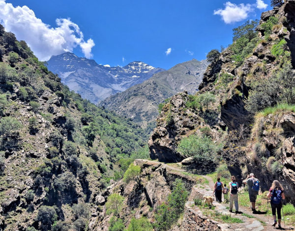
The route starts at the Barranco de San Juan. We follow the Río Genil and make our way up to the viewpoint at the Viso de las Nortes. We then continue up to the Minas de la Estrella. From here, we retrace our steps and make our way back to the starting point. Along the route, we have exceptional views of the Sierra Nevada, the peaks of Mulhacén, Veleta and Alcazaba, and the surrounding countryside.
Note: This is a very popular hike for the Granadinos. It is in most people's top 10. The normal route has an accumulated uphill of around 800m and a length of around 18km. This is a shortened version of the normal Vereda de la Estrella. You can find plenty of information about the full version on the internet if you search for it.
| Distance | 14.521 km |
| Duration | 4 hours 43 minutes GPX ------ 4 hours 36 mins (Naismith) |
| Total Climb | 388 m |
| Highest Point | 1513 m |
| Weather Link | Click here |
Meeting Point: Vereda de la Estrella: Parking
See map full screen Click here
Note: You can choose different types of maps using the drop down (top right) EG ArcGis Ariel is satelliteSorry we do not allow download of the gpx file of this walk because our group suffered a takeover by the weasly walkers. Click here if you would like to know what a walking group takeover is.
This page has been seen 2401 times since - 22nd May 2023