
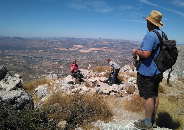

This circular walk starts at the Cortijo de las Minas and goes up to the Peñón de la Mata. The walk is 13.3km long, has an elevation of 659m and takes about 6 hours to complete.
The route starts at the Cortijo de las Minas in the Sierra de Huétor. From here, we make our way up to the Collado de Linillos, just below the famous Majalijar. We then climb up using the rope to the top with exceptional views of the Sierra de Huétor, the Peñón de la Mata and the Sierra Arana. Once we have arrived at the base of the Peñon, we round and start the ascent from the other side.
There is a section of rock climbing but it is worth it for the fantastic 360º views from the top.
We walk back to the base down a steep ridge and then on to the Cortijo de Carialfaqui. The route finishes with a final uphill section to return to the cars.
The walk has a medium-high level of difficulty.
Sierra Nevada from Peñon de la Mata
| Distance | 13.251 km |
| Duration | 4 hours 53 minutes GPX ------ 4 hours 58 mins (Naismith) |
| Total Climb | 659 m |
| Highest Point | 1663 m |
| Weather Link | Click here |
Meeting Point: Huétor Santillán: Gasolinera Repsol
See map full screen Click here
Note: You can choose different types of maps using the drop down (top right) EG ArcGis Ariel is satelliteSorry we do not allow download of the gpx file of this walk because our group suffered a takeover by the weasly walkers. Click here if you would like to know what a walking group takeover is.
This page has been seen 4038 times since - 14th September 2022