
This circular route explores the Sierra de Huétor and climbs up to the Cerro Buenavista. The route is 11.21 km long, has a elevation of 468 m and takes about 4 hours to complete.
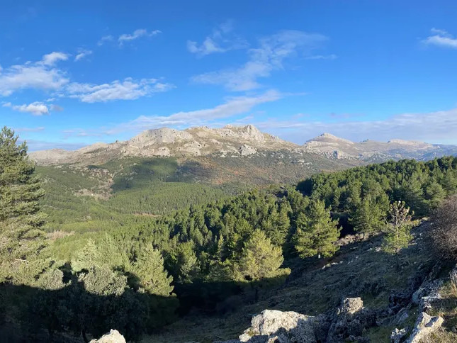
The route begins in the Llanos de Fátima in the Sierra de Huétor. We follow the track to the left and go up through the Dehesa de Beas until we find the path around the Cerro Oscuro. We pass an old farmhouse next to a quarry and continue on up the Collado del Lobo to the Cerro Buenavista at 1665 m with impressive views of the sierras. The second part of the route is almost all downhill until we return to the starting point.
| Distance | 11.206 km |
| Duration | 4 hours 29 minutes GPX ------ 3 hours 58 mins (Naismith) |
| Total Climb | 468 m |
| Highest Point | 1660 m |
| Weather Link | Click here |
Meeting Point: Sierra Huétor: Camino de la Cerrada
See map full screen Click here
Note: You can choose different types of maps using the drop down (top right) EG ArcGis Ariel is satelliteSorry we do not allow download of the gpx file of this walk because our group suffered a takeover by the weasly walkers. Click here if you would like to know what a walking group takeover is.
This page has been seen 2178 times since - 28th November 2023