
This circular clockwise route walks up from the Carmenes de San Miguel in Granada to El Fargue and down to the Abadía del Sacromonte. The route is 9.8 km long, has an elevation of 270 m and takes about 4 hours to complete.
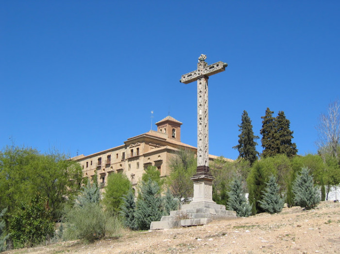
The route starts by the Carmenes de San Miguel in Granada. We follow the Cerro de San Miguel up to El Fargue, passing the electrical substation and the cemetery. We then make our way down to the Abadía del Sacromonte where there are fantastic views of the Alhambra, the Sacromonte and the city of Granada. We then continue on with a fairly level section through the Sacromonte hills before walking up to the Ermita de San Miguel and back to the starting point.
| Distance | 9.802 km |
| Duration | 3 hours 50 minutes GPX ------ 3 hours 8 mins (Naismith) |
| Total Climb | 270 m |
| Highest Point | 956 m |
| Weather Link | Click here |
Meeting Point: Granada: Cármenes San Miguel - El Fargue - Abadía del Sacromonte - Ermita de San Miguel
See map full screen Click here
Note: You can choose different types of maps using the drop down (top right) EG ArcGis Ariel is satelliteDownload GPX file We give you permission to download the gpx file of this route and follow it on your smartphone. Please note that we own the copyright to this file and you cannot upload it somewhere else in the same way that you can't copy a Beatles song and then claim that you made it. Click here if you would like to know more about copyright of internet content.
This page has been seen 2619 times since - 3rd October 2023