
This circular route explores de Parque Periurbano de la Dehesa del Generalife. The route is 13.76 km long, has an elevation of 294 m, and takes approximately 4 hours.
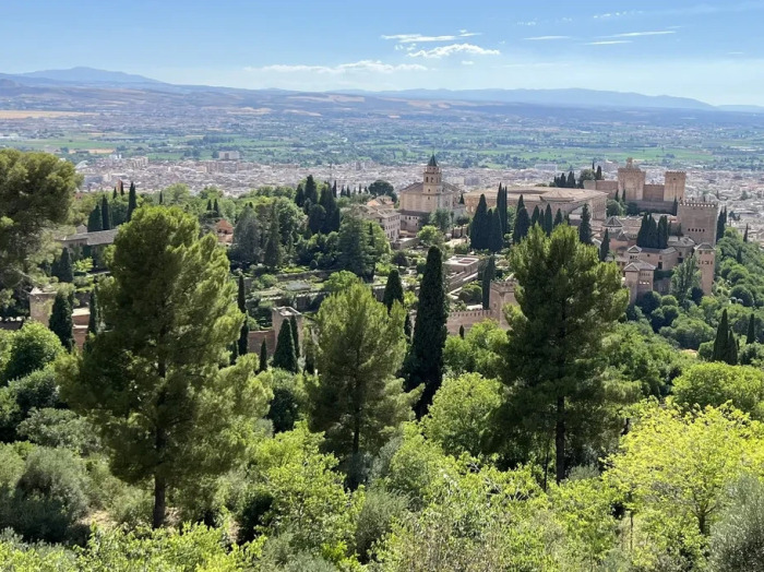
The route begins in the Urbanización Cerro del Sol, with sweeping views of the Sierra Nevada. We walk alongside the Canal de los Franceses, coinciding for a section with the Camino Mozarabe. We pass through the Periurban Park and the Llano de la Perdiz, a beloved spot for the people of Granada. We visit the Reloj del Sol and several viewpoints with views of Sacromonte and the Alhambra. Later, we pass the Aljibe de la Lluvia, Dar al-Arusa and the Silla del Moro before heading back to the starting point.
| Distance | 13.755 km |
| Duration | 3 hours 58 minutes GPX ------ 4 hours 10 mins (Naismith) |
| Total Climb | 294 m |
| Highest Point | 1017 m |
| Weather Link | Click here |
Meeting Point: Granada: Parking at Urbanización Cerro del Sol
See map full screen Click here
Note: You can choose different types of maps using the drop down (top right) EG ArcGis Ariel is satelliteDownload GPX file We give you permission to download the gpx file of this route and follow it on your smartphone. Please note that we own the copyright to this file and you cannot upload it somewhere else in the same way that you can't copy a Beatles song and then claim that you made it. Click here if you would like to know more about copyright of internet content.
This page has been seen 1948 times since - 20th October 2025