
This is the non official route between La Peza and Quentar. It would take around 7 hours has a distance of 23.3km and an uphill gain of 387 metres.
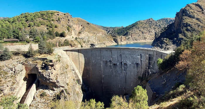
This is a much easier route than the official Camino de Santiago route. The official route has a total elevation gain of 734m and this route has 387m. It just follows the asphalt road. The is very little car traffic on this road mabe 1 car every few minutes. It is a popular cycle route with the people of Granada and you will see more bikes than cars. There is small town on the route called Tocón de Quentar. It does have a small restaurant but it is often closed. The advantage of going on this route is that you go past the reservoir which is visually very attractive.
| Distance | 23.309 km |
| Duration | 8 hours 1 minutes GPX ------ 6 hours 48 mins (Naismith) |
| Total Climb | 387 m |
| Highest Point | 1298 m |
| Weather Link | Click here |
Meeting Point: Plaza de España la Peza
See map full screen Click here
Note: You can choose different types of maps using the drop down (top right) EG ArcGis Ariel is satelliteDownload GPX file We give you permission to download the gpx file of this route and follow it on your smartphone. Please note that we own the copyright to this file and you cannot upload it somewhere else in the same way that you can't copy a Beatles song and then claim that you made it. Click here if you would like to know more about copyright of internet content.
This page has been seen 1599 times since - 28th October 2022