
This section of the Camino Mozárabe de Almería goes from the city of Guadix to Cortijo de la Plata (La Peza). The route is 25.5 km long, has an elevation of 712 m and takes about 10 hours to complete.
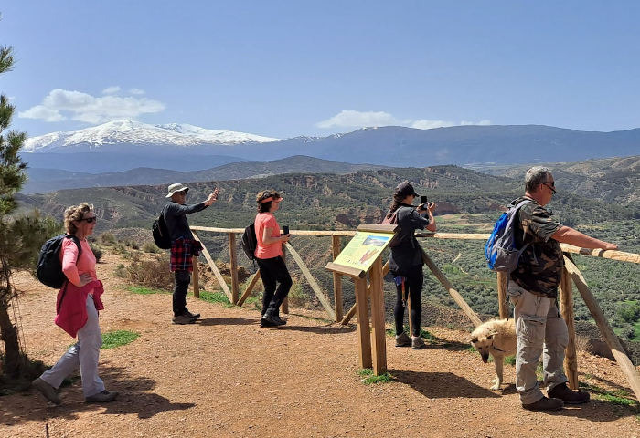
This section of the Camino Mozárabe de Almería starts in Guadix, a strategically important cathedral city between Almería and Granada. The route is mainly uphill. Once you leave Guadix, you mainly avoid main roads and there is some impressive scenery on the way as you walk through the heavily eroded badlands of Purullena, the first village you come to. You then walk on to the village of Marchal, and here begins the uphill ascent, gradual at first to reach the villages of Los Baños and then Graena, before becoming steeper as you walk along the main road and you get nearer to the village of La Peza. There is a viewpoint at the top of the hill and here you have an excellent view of the village below and the Arab castle on the opposite hill. You leave the main road at this point and follow the track on your left on to the Cortijo de la Plata. This route is for people who wish to stay at Cortijo de la Plata
| Distance | 25.466 km |
| Duration | 9 hours 43 minutes GPX ------ 8 hours 9 mins (Naismith) |
| Total Climb | 712 m |
| Highest Point | 1303 m |
| Weather Link | Click here |
Meeting Point: Plaza de la Catedral Guadix
See map full screen Click here
Note: You can choose different types of maps using the drop down (top right) EG ArcGis Ariel is satelliteDownload GPX file We give you permission to download the gpx file of this route and follow it on your smartphone. Please note that we own the copyright to this file and you cannot upload it somewhere else in the same way that you can't copy a Beatles song and then claim that you made it. Click here if you would like to know more about copyright of internet content.
This page has been seen 1378 times since - 9th March 2023