
This section of the Camino Mozárabe de Almería goes from Cortijo de la Plata to Quéntar. The route is 27.2 km long, has an elevation of 701 m and takes about 8.5 hours to complete.
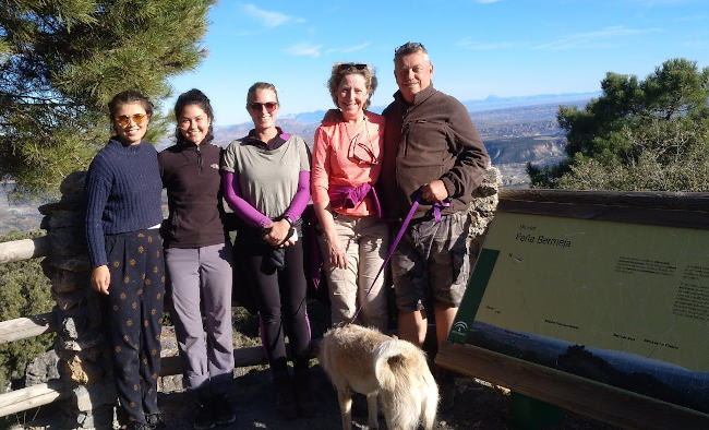
This section of the Camino Mozárabe de Almería starts at Cortijo de la Plata, near the village of La Peza. The first part of the walk is uphill as you make your way up through the holm oak and pine forests of Collado de la Plata, passing the viewpoint Mirador de Peña Bermeja with great views of the Guadix basin and the surrounding area. From here, you follow the track down to near Tocón de Quéntar, cross the main road to join the track which runs above the main road. As you approach the reservoir, there is a gentle uphill section before you begin the descent to Quéntar.
| Distance | 27.173 km |
| Duration | 8 hours 32 minutes GPX ------ 8 hours 33 mins (Naismith) |
| Total Climb | 701 m |
| Highest Point | 1579 m |
| Weather Link | Click here |
Meeting Point: Plaza de España la Peza
See map full screen Click here
Note: You can choose different types of maps using the drop down (top right) EG ArcGis Ariel is satelliteDownload GPX file We give you permission to download the gpx file of this route and follow it on your smartphone. Please note that we own the copyright to this file and you cannot upload it somewhere else in the same way that you can't copy a Beatles song and then claim that you made it. Click here if you would like to know more about copyright of internet content.
This page has been seen 1149 times since - 9th March 2023