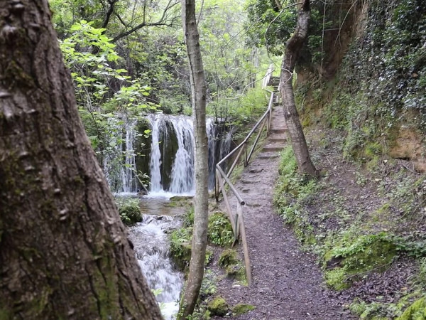

This circular route follows the Río Cerezuelo to the Cascada de la Malena near Cazorla. It is 10.2km long, has an elevation of 446m and takes approximately 4 hours to complete.
This circular route starts at the municipal swimming pool in Cazorla. We pass the castle as we leave the town and follow the route up to the Mirador de Riogazas. We then pass through the Riogazas picnic area and walk on to the Fuente Nacelrio. The track continues round past the Ermita de San Sebastián and back to the Río Nacelrio which we follow to the Cascada de la Malena where the Río Cerezuelo starts. From here, we make our way back to the starting point.
| Distance | 10.155 km |
| Duration | 3 hours 29 minutes GPX ------ 3 hours 39 mins (Naismith) |
| Total Climb | 446 m |
| Highest Point | 1135 m |
| Weather Link | Click here |
Meeting Point: Cazorla: Piscina Municipal
See map full screen Click here
Note: You can choose different types of maps using the drop down (top right) EG ArcGis Ariel is satelliteSorry we do not allow download of the gpx file of this walk because our group suffered a takeover by the weasly walkers. Click here if you would like to know what a walking group takeover is.
This page has been seen 3187 times since - 20th July 2022