
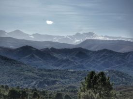
The route explores the Barranco del Hornillo at Puerto de La Ragua. The route is 7.86 km long, has an elevation of 287 m and takes approximately 3 hours to complete.
Elevation Gain: 287
292 views
More info
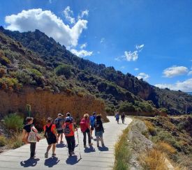
This circular route explores the hills south of Loja. The route is 9.41 km long, has an elevation of 308 m and takes approximately 3.5 hours to complete.
Elevation Gain: 308
505 views
More info
This circular route explores the Sierra del Manar near Otura. The route is 12.14 km long, has an elevation of 425 m and takes approximately 4.5 hours to complete.
Elevation Gain: 425
786 views
More info

This circular route explores the Granada Geopark near the Negratín Reservoir. The route is 13.45 km long, with an elevation gain of 426 m, and takes approximately 4.5 hours.
Elevation Gain: 426
1106 views
More info
This circular route explores de Parque Periurbano de la Dehesa del Generalife. The route is 13.76 km long, has an elevation of 294 m, and takes approximately 4 hours.
Elevation Gain: 294
1948 views
More info

This circular route begins in Cogollos Vega. The route is 9.68 km long, has an elevation of 227 m, and takes approximately 4 hours.
Elevation Gain: 223
915 views
More info

This circular route begins in Fonelas and explores the Geoparque de Granada. The route is 12.74 km long, has an elevation of 173 m, and takes approximately 4.5 hours.
Elevation Gain: 173
1087 views
More info

This circular route begins in Prado Negro. The route is 10.73 km long, has an elevation of 307 m, and takes approximately 4.5 hours.
Elevation Gain: 307
1063 views
More info

This circular route begins in Jérez del Marquesado. The route is 13.45 km long, has an elevation of 349 m, and takes approximately 4.5 hours.
Elevation Gain: 349
1125 views
More info

This is a linear walk river from Bérchules. The route is 10.23 km long, has an elevation of 222 m and takes approximately 4 hours to complete.
Elevation Gain: 222
556 views
More info

This circular river route starts in Capileira. The route is 9.66 km long, has an elevation of 407 m and takes about 4 hours to complete.
Elevation Gain: 408
731 views
More info

This linear route starts in Charches. The route is 11.26 km long, has an elevation of 308 m and takes about 4 hours to complete.
Elevation Gain: 308
882 views
More info

On this circular route we walk from La Peza to the Fuente de la Gitana. The route is 12.80 km long, has an elevation of 240 m and takes about 4 hours to complete.
Elevation Gain: 240
2069 views
More info

This route goes from Restabal to Saleres and then on to Albuñuelas. The route is 11.03 km long, has an elevation of 256 m and takes about 4 hours to complete.
Elevation Gain: 256
1133 views
More info

This circular route explores the Badlands area to the north of Guadix. The route is 10.41 km long, has an elevation of 179 m and takes about 3.5 hours to complete.
Elevation Gain: 180
1320 views
More info

This circular route explores the area around the village of La Peza. The route is 15.45 km long, has an elevation of 337 m and takes about 4.5 hours to complete.
Elevation Gain: 337
1345 views
More info

This circular route explores the hills to the south of the village of Agrón, near Ventas de Huelma. The route is 10.42 km long, has an elevation of 332 m and takes about 4 hours to complete.
Elevation Gain: 332
1772 views
More info

This circular route explores the springs, irrigation channels, and castle of Lanjarón. The route is 9.58 km long, has a 331 m elevation gain, and takes approximately 4 hours to complete.
Elevation Gain: 331
1874 views
More info

This circular walk explores the barrancos and hills to the west of Padul. The route is 11.86 km long, has an elevation of 296 m and takes about 4 hours to complete.
Elevation Gain: 296
1649 views
More info

This linear route walks from the Urbanización Cañadas del Parque near Padul up to the Cruz de la Atalaya. The route is 10.07 km long, has an elevation of 318 m and takes about 4 hours to complete.
Elevation Gain: 318
1787 views
More info

This circular route explores the area around Arenas del Rey. The route is 11.02 km long, has an elevation of 262 m and takes about 4 hours to complete.
Elevation Gain: 262
1458 views
More info
This circular route starts near the Casa Forestal de los Madroños in Tocón. The route is 11.24 km long, has an elevation of 288 m and takes about 4 hours to complete.
Elevation Gain: 288
1710 views
More info

The route explores the hills and the trenches around Alfaguara in the Sierra de Huétor. The walk is 10.52 km long, has an elevation of 188 m and takes about 3.5 hours to complete.
Elevation Gain: 188
1754 views
More info

This circular route explores the Paraje del Sotillo near Iznalloz. The route is 11.79 km long, has an elevation of 235 m and takes approximately 4 hours to complete.
Elevation Gain: 235
1700 views
More info

This circular route explores some of the villages and springs of La Taha in the Alpujarras. It is 6.78 km long, has a gradient of 331m and takes about 3 hours to complete.
Elevation Gain: 331
1836 views
More info

This circular route follows the acequias above Mecina Bombarón. The route is 8.88 km long, has an elevation of 199 m and takes approximately 3 hours to complete.
Elevation Gain: 199
2483 views
More info

This circular route starts near the Pradollano Ski Resort. The route is 7.78 km long, has an elevation of 185 m and takes about 3 hours to complete.
Elevation Gain: 185
1617 views
More info

This linear route starts in Beas de Granada and finishes in Granada. The route is 15.43 km long, has an elevation of 99 m and takes about 5 hours to complete.
Elevation Gain: 99
2449 views
More info

This circular route starts in Beas de Granada. The route is 10.21 km long, has an elevation of 268 m and takes about 4 hours to complete.
Elevation Gain: 268
1450 views
More info

On this circular route we walk from La Peza to the Fuente de la Gitana. The route is 11.64 km long, has an elevation of 255 m and takes about 4 hours to complete.
Elevation Gain: 255
2013 views
More info

The route explores some of the most important peaks near El Purche. The route is 7.3 km long, has an elevation of 300 m and takes about 3,5 hours to complete.
Elevation Gain: 300
2255 views
More info

This route explores the hills just south of the village Tocón de Quéntar. The route is 12.95 km long, has an elevation of 432 m and takes about 4.5 hours to complete.
Elevation Gain: 432
1687 views
More info

This route explores the area south of Monachil. The route is 10.87 km long, has an elevation of 344 m and takes approximately 4.5 hours to complete.
Elevation Gain: 344
1680 views
More info

On this circular route, we walk from the village of Diezma to the Río Fardes and back. The route is 11.59 km long, has an elevation of 284 m and takes about 4.5 hours to complete.
Elevation Gain: 284
1458 views
More info

This route begins in the village of Albuñuelas in the Valle de Lecrin. The route is 11.01 km long, has an elevation of 388 m and takes approximately 4.5 hours to complete.
Elevation Gain: 388
1542 views
More info

The route starts near Venta El Puente. The route is 9.68 km long, has an elevation of 208 m and takes about 4 hours to complete.
Elevation Gain: 208
4483 views
More info

This circular route follows the Río Genil from Cenes de la Vega to Pinos Genil. The route is 10.89 km long, has an elevation of 100 m and takes about 4 hours to complete.
Elevation Gain: 100
4008 views
More info

This circular route begins and ends in Béznar in the Valle de Lecrín. The route is 12.49 km long, has an elevation of 409 m and takes about 4 hours to complete.
Elevation Gain: 409
1714 views
More info

This circular route explores the Sierra de Huétor and climbs up to the Cerro Buenavista. The route is 11.21 km long, has a elevation of 468 m and takes about 4 hours to complete.
Elevation Gain: 468
2178 views
More info

A circular route that goes from Quéntar to Beas de Granada and back to Quéntar. The route is 11.46 km long, has an elevation of 443 m and takes about 4 hours to complete.
Elevation Gain: 443
1807 views
More info

This circular clockwise route explores the acequias and miradores around the village of Dílar. The route is 10.25 km long, has an elevation of 133 m and takes about 4 hours to complete.
Elevation Gain: 133
2949 views
More info

This circular clockwise route walks up from the Carmenes de San Miguel in Granada to El Fargue and down to the Abadía del Sacromonte. The route is 9.8 km long, has an elevation of 270 m and takes about 4 hours to complete.
Elevation Gain: 270
2610 views
More info

This circular route walks explores the Sierra de Baza. The route is 10.62 km long, has an elevation of 342 m and takes about 4 hours to complete.
Elevation Gain: 342
2294 views
More info

This circular route walks from the village of Dúdar up tothe Mirador de Quéntar. The route is 10.5 km long, has an elevation of 414 m and takes about 4 hours to complete.
Elevation Gain: 414
2452 views
More info

This route starts at Posiciones de Veleta and finishes at Hoya de la Mora. The route is 11,65 km long, has an elevation of 282 m, and takes about 4.5 hours to complete.
Elevation Gain: 282
4218 views
More info

This circular route starts in the village of Castril and follows the Río Castril to the reservoir. The route is 9.77 km long, has an elevation of 258 m and takes about 4 hours to complete.
Elevation Gain: 258
1941 views
More info

This circular route walks up from Puerto de la Ragua to the Refugio El Toril. The route is 9.45 km long, has an elevation of 264 m and takes approximately 4 hours to complete.
Elevation Gain: 264
3160 views
More info

This linear route starts at the Barranco de San Juan and walks up to the Minas de la Estrella. The route is 14.5 km long, has an elevation of 388 m and takes approximately 4.5 hours to complete.
Elevation Gain: 388
2402 views
More info

This route starts in the village of La Peza and goes up to the Casa Forestal del Nabogar. The route is 11.9 km long, has an elevation of 409 m and takes about 4 hours to complete.
Elevation Gain: 409
1858 views
More info

This route explores the hills above Monachil. The route is 12.2 km long, has an elevation of 403 m and takes about 4 hours to complete.
Elevation Gain: 403
2389 views
More info

This circular route explores the hills above the village of Quéntar. The route is 14.3 km long, has an elevation of 488 m and takes about 5 hours to complete.
Elevation Gain: 488
2974 views
More info

This route walks up to the Atalaya del Marcha. The route is 10.2 km long, has an elevation of 381 m and takes about 4 hours to complete.
Elevation Gain: 381
1987 views
More info
This circular route explores the area above and around Nigüelas. The route is 10.32 km long, has an elevation of 479 m and takes about 4 hours to complete.
Elevation Gain: 437
2327 views
More info

This route climbs up to the Ermita del Cristo del Zapato from the Embalse de Béznar. The route is 10.5 km long, has an elevation of 536 m and takes about 4 hours to complete.
Elevation Gain: 536
4797 views
More info

This circular, clockwise route explores the hills above Tocón de Quéntar. The route is 15km long, has an elevation of 416m and takes about 5 hours to complete.
Elevation Gain: 416
2088 views
More info

This clockwise circular route goes from the village of Dúdar to the Dehesa del Generalife and passes the Canal and the Acueducto de los Franceses. It is 13.4km long, has an elevation of 377m and takes approximately 5 hours to complete.
Elevation Gain: 377
2712 views
More info

This circular route explores the Parque Periurbano Dehesa de Santa Fe. The route is 12.5km long, has an elevation of 239m and takes about 4.5 hours to complete.
Elevation Gain: 239
2008 views
More info

This circular route explores the area around Deifontes with its fountains and Arab watchtower. The route is 13.59 km long, has an elevation of 462 m and takes about 5 hours to complete.
Elevation Gain: 462
2688 views
More info

This circular route explores the area around Aldeire and is a great walk in the autumn when the trees are changing colour. The route is 12.5km long, it has an elevation of 370m and it takes about 4 hours to complete.
Elevation Gain: 370
1784 views
More info

This circular clockwise route explores the Geoparque area near the village of Bácor. The route is 13.8km long, it has an elevation of 430m and it takes about 4.5 hours to complete.
Elevation Gain: 430
2398 views
More info

This circular route explores the area around Lanteira. It is 10.88 km long, has an elevation of 237 m and takes about 4 hours to complete.
Elevation Gain: 237
2001 views
More info

This circular route explores the Llanos de Monachil and follows the Arroyo de Huenes. The walk is 11.8km long, has an elevation of 331m and takes about 4 hours to complete.
Elevation Gain: 331
2321 views
More info

This spectacular Autumn circular walk passes through the Chestnut grove near Paterna del Río and follows the Acequia Real. It is 11.4km long, has an elevation of 505m and takes approximately 4 hours to complete.
Elevation Gain: 490
1836 views
More info

This is the circular longer version of the El Chullo hike. El Chullo is the highest peak in the province of Almería - El Chullo has an altitude of 2619m. The route is 15.2km long, has an elevation of 679m and takes approximately 6 hours to complete.
Elevation Gain: 679
2299 views
More info

This anticlockwise circular route goes from the Centro de Visitantes Puerto Lobo to the Cruz de Víznar. It is 11.2km long, has an elevation of 432m and takes approximately 4 hours to complete.
Elevation Gain: 432
3281 views
More info

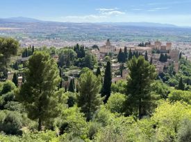
This circular anticlockwise route explores the Parque Periurbano Dehesa del Generalife above Granada near the Alhambra. The walk is 10.2km long, has an elevation of 331m and takes about 4 hours to complete.
Elevation Gain: 331
2349 views
More info

This is a linear route from Lanjarón to Cañar and then on to Órgiva. The walk is 11.2km long, has an elevation of 436m and takes about 5 hours to complete.
Elevation Gain: 436
2479 views
More info

This anti-clockwise circular walk begins in the village of Nívar. The walk is 12.9km long, has an elevation of 340m and takes about 4.5 hours to complete.
Elevation Gain: 340
2364 views
More info

This circular walk starts at the Ermita Nueva in Dílar and goes up to the Silleta del Padul and the Piedra Ventana. It is 14.2km long, has an elevation of 770m and takes about 5 hours to complete.
Elevation Gain: 770
1592 views
More info

This circular clockwise walk starts near the Fuente El Hervidero near Cumbres Verdes. It is 10km long, has an elevation of 381m and takes approximately 4 hours to complete.
Elevation Gain: 381
3606 views
More info

This circular walk starts near Huétor Santillán. It is 10.82km long, has an elevation of 294m and takes approximately 4 hours to complete.
Elevation Gain: 244
2030 views
More info

This circular walk starts in the village of Güéjar Sierra. It is 12.4km long, has an elevation of 289m and takes approximately 4 hours to complete.
Elevation Gain: 289
8859 views
More info

Circular walk around La Peza to explore the most important monuments and places in the village. The walk is 1.85km long, has an elevation of 69m and takes about an hour to complete.
Elevation Gain: 69
1241 views
More info

This circular walk starts at the Centro de Visitantes el Dornajo on the Carretera de la Sierra. It is 11.6km long, has an elevation of 544m and takes approximately 4 hours to complete.
Elevation Gain: 544
1791 views
More info

This linear route in the Sierra Nevada goes from the Hoya de la Mora to the Lagunillas de la Virgen. It is 12km long, has an elevation of 468m and takes approximately 4 hours to complete. This is a summer walk when there is no snow.
Elevation Gain: 468
9048 views
More info

This linear route follows the Río Dúrcal to the Cascada de los Bolos. It is 10.1km long, has an elevation of 185m and takes approximately 4 hours to complete.
Elevation Gain: 185
4092 views
More info

This is a linear route to the Río Dílar waterfall. It is 11.8km long, has an elevation of 250m and takes approximately 4 hours to complete.
Elevation Gain: 248
3268 views
More info

Route length: 8.5 km Estimated duration: 3 h 30 m Starting altitude: 2,030 m Maximum altitude reached: 2,613 m Maximum positive slope: 605 m. It is the highest point in the province of Almeria, there is a panoramic view from the top.
Elevation Gain: 580
3441 views
More info

A fairly easy walk with water features not far from Capileira. 11.73 km with 480 elevation gain. The altitude is between 1,480m and 1790m
Elevation Gain: 480
2840 views
More info

This linear route walks from Hoya de la Mora up to El Cartujo in the Sierra Nevada. It is a fairly hard walk with an elevation of 704m, it is 16.2km long and takes approximately 6.5 hours to complete.
Elevation Gain: 704
2523 views
More info

This anti-clockwise, loop walk starts at the Aguas Blancas área recreativa. It is 9.7km long, has an elevation of 270m and takes approximately 2.5 hours to complete.
Elevation Gain: 270
2949 views
More info

This anti-clockwise, circular walk starts at the Aguas Blancas área recreativa. It is 10.5km long, has an elevation of 289m and takes approximately 3.5 hours to complete.
Elevation Gain: 289
2715 views
More info

This is a linear route between Fuente de la Gitana and La Peza. The walk is 12.6km long and takes about 4 hours to complete.
Elevation Gain: 314
1689 views
More info

This route follows the Collado del Diablo. The walk is 13.9km long and takes about 5 hours to complete.
Elevation Gain: 344
2853 views
More info

This circular route explores the Sierra de Huétor and Prado Negro. The walk is 11.83 km long, has an elevation of 257 m and takes approximately 4 hours to complete.
Elevation Gain: 257
3341 views
More info

This circular route was traditionally used to walk up to the Sierra Nevada from Granada. The walk is 9km long and takes about 3.5 hours to complete.
Elevation Gain: 670
2240 views
More info

This route explores the area behind the village of Diezma and visits the villages of Sillar Bajo and Los Villares. The walk is 14.4km and takes about 5 hours to complete.
Elevation Gain: 400
2181 views
More info

This is the most popular hike for visitors to Granada. It is a fairly easy 8km with an uphill of 342m. It includes a riverside walk in a gorge, a rope bridge and some farmland.
Elevation Gain: 342
3041 views
More info

This walk follows part of the tram network between Güéjar Sierra and the Sierra Nevada. The walk is 10.3km long and takes about 3 hours to complete.
Elevation Gain: 189
8234 views
More info

This route explores the area around Beas de Granada, the River Beas and the Barranco de Puerto Blanco. The walk is 12.9km long and takes about 4.5 hours to complete.
Elevation Gain: 333
2552 views
More info

This circular walk starts next to the Pantano de Quéntar near the village of Quéntar. It is 12.96 km long, has an elevation of 371 m and takes approximately 4 hours to complete.
Elevation Gain: 371
4032 views
More info

A 15km walk around well-defined paths between Tocón and La Peza
Elevation Gain: 335
1560 views
More info

This a linear walk between Baños de Graena and the Mirador Fin del Mundo with views of the Cárvacas de Marchal. The walk is 9.9 km long, has an elevation of 250 m and takes about 4 hours to complete.
Elevation Gain: 250
3029 views
More info

This clockwise route explores the area around Benalua, the Badlands of Guadix in the Geopark. The walk is 14.8km long, has an elevation of 226m and takes about 5 hours to complete.
Elevation Gain: 226
2123 views
More info

This route explores the area of Dúrcal with its castle and thermal baths. The walk is 14.5km long and takes about 4.5 hours to complete.
Elevation Gain: 213
3144 views
More info

This circular route explores the Sierra de Huétor.
Elevation Gain: 298
3155 views
More info

The route explores the hills and the trenches around Alfaguara in the Sierra de Huétor. The walk is 9.8km long and take about 3 hours to complete.
Elevation Gain: 340
2065 views
More info